geoenrich 1.0.1 documentation


![]()
GeoEnrich provides functionalities to enrich georeferenced events (such as species occurrences) with environmental data from satellites or models. Users can specify a geographic or temporal buffer to include data in the neighbourhood of occurrences into their analyses. Two main outputs are available: a simple summary of the variable in the requested area, or the full data (as a geotiff raster, a png image, or a numpy array).
Sea surface temperature, chlorophyll, and 40 other environmental variables are available natively, and other sources can easily be added by the user. This package is intended for large numbers of occurrences: local storage is implemented to avoid redundant requests to remote servers.
The package provides functions to retrieve occurrence data directly from GBIF, or open a custom dataset from any source. Arbitrary areas defined by the user can also be enriched.
Source on GitHub at morand-g/geoenrich
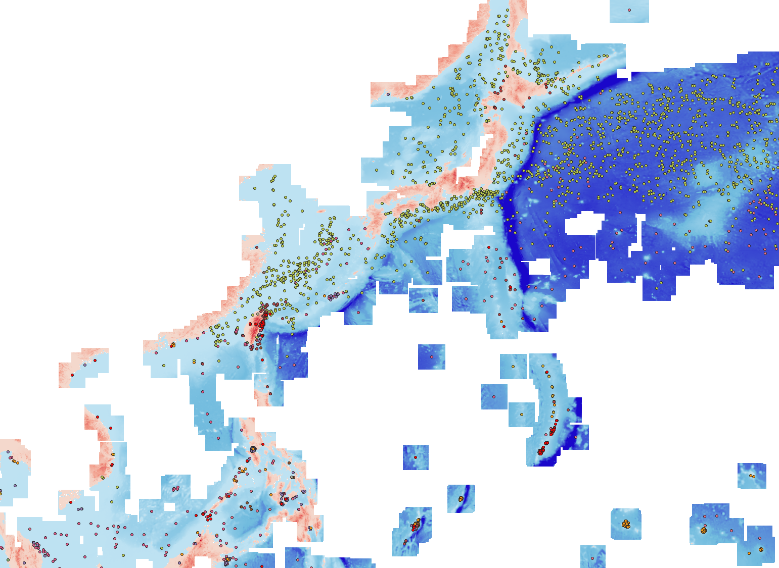
Illustration of an occurrence dataset enriched with bathymetry data
This project is being developed as part of the G2OI project, cofinanced by the European union, the Reunion region, and the French Republic.
How to cite
As this package is distributed under a GPLv3 license, you have no obligation to cite the authors when you use it. If you want to cite the package to ensure reproducibility, please consider doing it the following way:
Morand, G., Nabil, T., Poulain, S., Barde, J. & Mouillot, D. (2026). GeoEnrich v1.0.1: a new tool for scientists to painlessly enrich species occurrence data with environmental variables (v1.0.1). Zenodo. http://doi.org/10.5281/zenodo.6458090
You can find the specific DOI for the version you are using on the package’s Zenodo page.
Modules
- Dataloader module
The dataloader module: import DarwinCore archives, download data from GBIF.
- Enrichment module
The enrichment module: download enrichment data, handle enrichment files.
- Exports module
The exports module: retrieve downloaded data, calculate statistics, export data to pictures.
- Satellite module
The satellite module (internal use): netCDF file handling, data download, data retrieval.